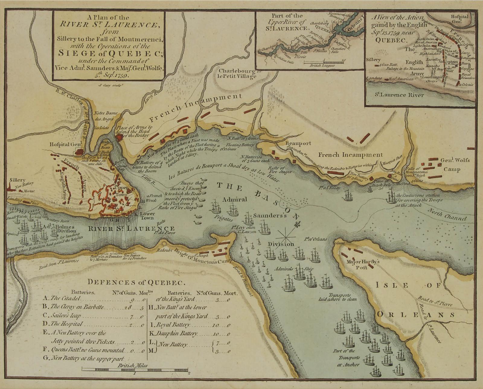
A Plan Of The River St. Laurence From Sillery To The Fall Of Montmorenci, With The Operations Of The Siege Of Quebec Under The Command Of Vice-Adml. Saunders & Majr Genl. Wolfe, 5th Sept. 1759
12.75 cms (5.02 ins)
One of the first maps of the area to be printed in London following the news of the British victory on the Plains of Abraham and widely considered to be the most authoritative contemporary pictorial depiction of the series of events leading up to the battle, and the most important printed map in Canadian history.
made in 1759
Lot offered for sale by Waddington's, Toronto at the auction event "Canadian Art, Culture and History" held on Thu, Nov 12, 2020.
Lot 67
Lot 67
Estimate: CAD $200 - $300
Realised: CAD $1,440
Realised: CAD $1,440